Thematic maps are maps used to illustrate a particular element of a geographical location, such as: climate, demographics, political data and land distribution. Thematic maps differ from reference maps in that reference maps are general purpose maps that provide information on common features such as; boundaries, cities, transportation and landmarks. Thematic maps are specific to a certain subject related to the geographical location.
Three thematic maps of Mongolia including: ethnicities, vegetation zones, and geothermal heat flow.
Vegetation Zones (Chloropleth Map)
The vegetation zone map is a chloropleth type thematic map that shows different elements of vegetation and lack of vegetation in Mongolia. In addition to the natural vegetation, lake elements can also be seen. Each element is represented by separate shading.

Source: http://www.mongols.eu/maps-of-mongolia/thematic-maps/
Ethnic Nationalities (Chloropleth Map)
The ethnic nationalities map is a chloropleth type thematic map that shows different distributions of Mongolian cultural ethnicities. Each shading represents a specific group of ethnic Mongolians.

Source: http://www.mongols.eu/maps-of-mongolia/thematic-maps/
Geothermal Map (Isopleth Map)
Geothermal map is a isopleth type thematic map that shows different elements of heat flow in Mongolia. Each line represents an element of heat to be used as a renewable resource.
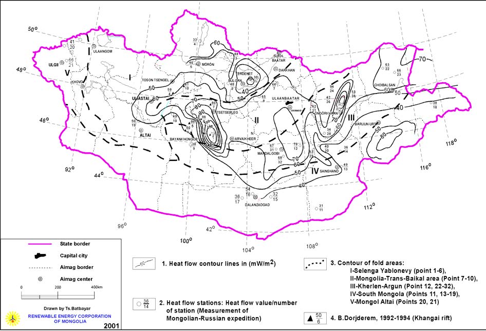
Source: http://www.geni.org/globalenergy/library/renewable-energy-resources/world/asia/geo-asia/geo-mongoliabig.shtml
No comments:
Post a Comment