Sunday, April 12, 2015

Ulaanbaatar

Also known as Ulan Bator, is the capitol of Mongolia. Ulaanbaatar translates literally into "Red Hero". With a population well over 1.2 million, it is the largest city in Mongolia. The city originated as a nomadic Buddhist center, and in 1778 became a permanent settlement. Ulaanbaatar has grown into a prosperous manufacturing capitol in recent years, which has had the consequence of producing serious amounts of air pollution. Which is also combined with pollution from nearby China. 


Short Video Exploring Ulaanbaatar


Blue Sky Tower, probably the most recognizable attraction in Ulaanbaatar
Source: M.A.D. research.com

Buddhist Temple
Source: Vagabond Journey
Genghis Khan Monument
Source: Travel Pod
Ulaanbaatar District
Source: Discover Mongolia
Old Soviet Wall Murals
Source: The World Effect

Sunday, April 5, 2015

Economic Activities

Being a pastoral and agricultural society, it is of no surprise that one of Mongolia's primary exports are in livestock. In my previous blog article, I discussed how Mongolia's environment makes farming difficult, but ideal for livestock. This is reflected through statistics concerning Mongolian exports where profits in 2007 were equal to $24,172,425. The primary exports are largely livestock since any form of farming is largely regulated towards the livestock and maintaining of the livestock.


Mining in Mongolia
Source: Unuudur.com

In addition to exporting animals, Mongolia also has a huge economic sector in mining and mineral exports due to being on one of the world's largest sources of precious and rare metals. Various metals and ores from sulfur to mineral fuels and precious metals are exploited for trade mostly to China for the use in manufacturing. 


Mongolia's only other significantly profitable industries are in textiles and vehicular equipment, but these industries aren't nearly as important as the mining and live stock industries. 


 "Mongolia Exports by Product Section in US Dollars - Yearly." Mongolia Exports by Product Section in US Dollars - Yearly. Web. 5 Apr. 2015.  


Sunday, March 29, 2015

Agriculture in Mongolia

Source: mytripblog.org
Mongolian Herders
Agriculture is one of Mongolia's strongest and primary industries. In fact, almost half of the population is engaged in the agricultural industry. With a livestock population of 30 million, people are outnumbered ten-to-one. Mongolia's harsh climate makes traditional cultivation impossible. In fact, only 1% of Mongolia is cultivable. This means that livestock is the primary form of agriculture. Most of the livestock consists of: sheep, yak, goats, cattle, camels and horses. Aside from the livestock, the only main crops that can be grown in Mongolia's rough environment consist of: wheat, barley, potato, cabbage and carrots.

Source: ADRA (Adventist Development and Relief Agency)
Mongolia's harsh climate makes farming difficult


As mentioned before, Mongolia's harsh climate makes farming difficult and nearly impossible. Being an ex-Soviet satellite country, Mongolia's wells and watering holes, once maintained collectively were left to deteriorate. The lack of pasture management, combined with summer droughts and dzuds (slow winters), have prevented herders from stocking enough fodder for the winter months. Poor management skills, inadequate input systems and low quality seeds have contributed to an 80 per cent fall in overall productivity and, while wheat yields have begun to recover, they remain low. With a lack of markets and proper food storage techniques, much of Mongolia is facing concerns about food safety. Regardless, Mongolia is still ranked highly for it's agricultural land. 


"New Agriculturist." : Country Profile. Web. 29 Mar. 2015. 


Sunday, March 15, 2015

Human Development


What is Human Development? 

More specifically, what is the study of human development compared among individual countries? To answer this question we must examine the measures of what human development attempts to analyze. The Human Development Index seeks to quantify the level of life expectancy, education, and income equality based on interal factors within the country. The human development index was introduced as an alternative measure to the analysis of a countries GDP. The human development index accounts for human well-being as opposed to purely economic factors. 
"Human Development Reports." The Human Development Index – What It Is and What It Is Not. Web. 15 Mar. 2015.

People First : Human Development Reports

Mongolia is ranked 103 on the Human Development Index with an index of 0.698, that has had a steady increase since the 1980s possibly due to modernization and globalization. Largely an agrarian society, many Mongolians have had steady employment due to the farming industry, and have an average life expectancy of 67.5 years.

Mongolia's Human Development in comparison to other countries
Source: Human Development Reports

What is of interest on the Human Development Index are the numbers concerning education, gender equality and CO2 emissions:

Source: China daily


Expected schooling for Mongolians is ranked at 15 years, yet the average amount of school is 8 years, which may be due to the agrarian society. Mongolians are required for farming as opposed to schooling, and with labor being confined to agriculture there is not much need for education.


Source: http://preventionaction.org/
The same anomaly can be observed in gender equality, which is surprisingly equal with a ranking of 0.32, which may also be due to the agrarian lifestyle. There tends to be a pattern of gender inequality in developing countries, which Mongolia is part of, yet little gender inequality exist at all. In fact, there are even more women who possess higher degrees of education 
in comparison to men.


Carbon Emissions levels also showed some interest. Since Mongolia is largely an agrarian society, one would expect the carbon emission levels to be low, but Mongolia also borders China, the most polluted and greenhouse gas producing country in the world. This pollution likely spreads north to Mongolia where it affects the population and introduces high levels of smog. 
Source: http://rising.globalvoicesonline.org/


Sunday, March 1, 2015

Population Income Statistics of Mongolia


Facts from the World Bank concerning Mongolia.

Mongolia is a developing East Asian and Pacific country. The population has a steady birth rate of 20.7 births/1,000 population and a death rate of 6.01 deaths/1,000 population. As of 2013, the population was 2.839 million and continues to significantly grow. 

Mongolia's GDP is equal to $11.52 billion per year. Most Mongolians earn an income that would be classified as lower middle class. According to predictions, Mongolia's GDP is expected to remain at a constant level without any increase or decrease.
In terms of poverty levels, 27.4% of the population is below the poverty line.

Poverty Rates
Source: worldbank.org


In relation to education, primary school enrollment has a level of 117% percent. 


Misc. Statistics:
C02 Emissions (metric tons per capita): 4.2

Rural population water access: 61%
Life expectancy: 61
Therefore, Mongolia can be considered one of the more prosperous developing countries.

Mongolia's economic development in comparison to the rest of developing Asia
Source: Finance for Australian Exporters 

Monday, February 16, 2015

Statistics of Mongolia


Facts from the CIA World Factbook concerning Mongolia.

As of July 2014, Mongolia has a population of 2,953,190 ranking it 139th in the world. 

Source: http://www.mongolia-tours.com/mongolian-culture-traditions.htm

The population grows at a rate of: 1.37%
A death rate of: 6.38 deaths/1,000 population (2014 est.)
A total fertility rate of: 2.22 children born/woman (2014 est.)
With a birth rate of: 20.88 births/1,000 population (2014 est.)

Median Age:

male: 26.3 years
female: 27.8 years (2014 est.)
Average total: 27.1 years

Infant mortality rate: 23.15 deaths/1,000 live births
Life expectancy at birth: 68.98 years


The largest city remains to be Ulaanbaatar (capital) at a population of 1.184 million in 2011. The Urban population rests at 68.5% of the total population in 2011. 

Source: http://ubpost.mongolnews.mn/?p=1611


Other Statistics Concerning Mongolia:

Obesity: 14.4% (2008 statistics)
Literacy: defined as being able to read and write at the age of 15 and over 
total population: 97.4%

Unemployment total: 11.9%

Source: http://topcarl.com/the-28-best-and-worst-countries-for-people-who-love-to-breathe/


HIV/AIDS related statistics:

Adult prevalence rate:
less than 0.1% (2009 est.)
country comparison to the world: 161

People living with HIV/AIDS:
fewer than 500 (2009 est.)
country comparison to the world: 160

Deaths:
fewer than 100 (2009 est.)
country comparison to the world: 140

Traveler Concerns: Although there are no health notices concerning Mongolia, the CDC advises routine vaccinations for Hepatitis A and B, Typhoid and Rabies. 

Friday, January 30, 2015


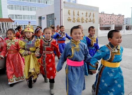
Mongolian Cultural Symbols


Mongolia's land itself can be described as barren and unforgiving, but what lies beneath are treasures from one of the greatest empires to ever exist.
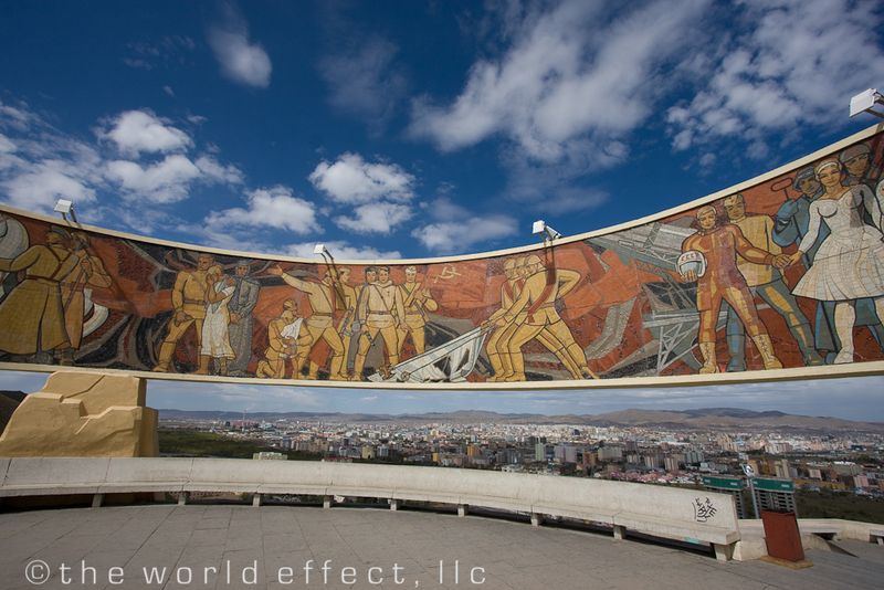
Mongolia was once the home capital of one of the largest empires to exist in history, only being beat by the British empire in population. Therefore, Mongolia is home to many cultural and historical symbols regarding it's history of the nomadic Mongols.

One such symbol is the horse
Source: http://s1.ibtimes.com/sites/www.ibtimes.com/files/styles/picture_this/public/2012/04/06/259181-mongolia.jpg?itok=yvzoc_eV

While not exclusive to Mongolia, mastery of the horse is the most recognizable trait among Mongols. The horse was (and still is) the most reliable mode of transportation for the steppes that populate most of Mongolia. Genghis Khan’s Golden Horde, that created one of the largest empires to ever exist, would not have been successful without the horse’s speed, mobility and agility. To this day, the horse is still used as a mode of transportation (in competition with camels) among villagers for primary transportation. 


To go along with horses, the Mongolian steppes are another recognizable symbol of Mongolia. 

Source: http://www.shropshiremagazine.com/wp-content/uploads/2011/08/aug11-patersonb.jpg

The steppes are a geographic combination of plains, canyons, deserts, hills and mountains all together. As such, mobility can be quite limited without proper transport. This sometimes harsh landscape is what permitted the Mongols of the Golden Horde to have such highly skilled horse mounted warriors. Certain elements of the steppes are ideal for farming though. Therefore, farming has been a dominant industry in Mongolia for centuries. 


While many other symbols exist to represent Mongolia, the Yurt is what many would find to be the most interconnected with Mongolia's nomadic history and culture.

Source: http://www.beagleybrown.com/wp-content/uploads/2010/09/Mongolian-yurt.jpg
The Yurt is a traditional Mongolian home (and actually translates to home) designed to suit the needs of a nomadic tribesman. They are easily constructed and deconstructed and can withstand the harsh elements of the steppes. While some villages still make use out of Yurts in Mongolia, the Yurt is generally what the Tipi is to Americans. A symbol of the original and historical culture. 

Friday, January 23, 2015

Three Thematic Maps


Thematic maps are maps used to illustrate a particular element of a geographical location, such as: climate, demographics, political data and land distribution. Thematic maps differ from reference maps in that reference maps are general purpose maps that provide information on common features such as; boundaries, cities, transportation and landmarks. Thematic maps are specific to a certain subject related to the geographical location.

Three thematic maps of Mongolia including: ethnicities, vegetation zones, and geothermal heat flow.

Vegetation Zones (Chloropleth Map)

The vegetation zone map is a chloropleth type thematic map that shows different elements of vegetation and lack of vegetation in Mongolia. In addition to the natural vegetation, lake elements can also be seen. Each element is represented by separate shading.

Source: http://www.mongols.eu/maps-of-mongolia/thematic-maps/

Ethnic Nationalities (Chloropleth Map)

The ethnic nationalities map is a chloropleth type thematic map that shows different distributions of Mongolian cultural ethnicities. Each shading represents a specific group of ethnic Mongolians. 

Source: http://www.mongols.eu/maps-of-mongolia/thematic-maps/

Geothermal Map (Isopleth Map)


Geothermal map is a isopleth type thematic map that shows different elements of heat flow in Mongolia. Each line represents an element of heat to be used as a renewable resource.

Source: http://www.geni.org/globalenergy/library/renewable-energy-resources/world/asia/geo-asia/geo-mongoliabig.shtml